Preparing for LRT in Brooklyn Park
Station plans
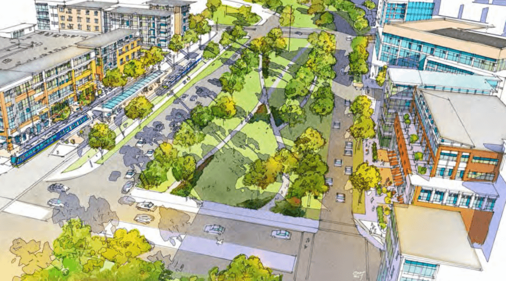
The City of Brooklyn Park adopted Station Area Plans for each of the five planned stations in the city in 2016. These plans are included in the City’s Comprehensive Plan and will guide future development to take advantage of the regional investment in light rail transit.
Click here to read the Brooklyn Park station area plans (PDF) >
TOD zoning
Transit-oriented development (TOD) zoning gives direction to the design of buildings, sidewalks, parking, and other infrastructure. TOD zoning promotes walkability and a mixture of uses, such as office, retail, and residential. To make station areas welcoming, pleasant, and accessible to all transit riders, the City of Brooklyn Park adopted Transit-oriented Development (TOD) zoning standards in July 2018. Based on years of station area planning, it was determined this is the best way to ensure high-quality development along the line.
West Broadway Avenue Streetscape Design Manual
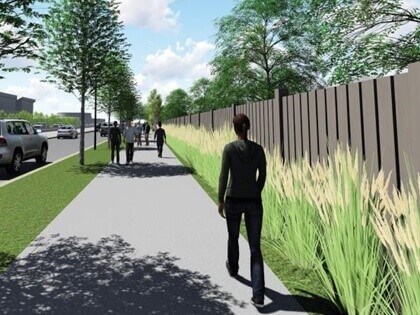
LRT is not the only new element coming to West Broadway Avenue. Along with construction of the train, the streetscape will undergo changes to include a multi-use trail and new landscaping on both sides of the road. Reconstruction of the road will allow the trails, cars, and train to exist together safely. Some small strips of land along the corridor will be acquired to make room for the trails and streetscape improvements.
In fall of 2017, Blue Line project staff from the Met Council and Hennepin County talked to the impacted property owners and discussed the acquisition process and minimizing negative effects on property values. Conversations with affected property owners are ongoing. Overall, project staff anticipates minimal impacts to properties and limited acquisitions along West Broadway Avenue.
This image shows the landscaping improvements, new residential fence, and trail along West Broadway Avenue.
See the West Broadway Streetscape Framework Manual here (PDF) >